24.7.06


The GR128
From Wolvertem to Mazenzele


8-7-2006. Wolvertem on the old freeway from Antwerp to Brussels. We parked our car in Mazenzele and left a bike (for me to come back on) in Wolvertem. Right onto the small fields paths and away from tar and car.
Almost the entire route consisted of non paved roads and amazingly we encountered few dogs and only an occasional sewer smell bothered us.
Halfway we "discovered" the starting point of the GR126.
It is a fairly flat section of the GR128 with a max. altitude of 80 m. The lowest point being at 20 m.
It took us 6 hours to cover the 19,9 km.
Personal rating ****

11.7.06


Poco de Inferno 22-6-7

Manteiras in the Portugese Serra de Estrela was the starting Point of our 18 km trip to the Poco the Inferno, an impressive waterfall in this protected highland area. And due to the Portuguese dislike of strenuous walks there is a fully paved road to this site. Not that we saw many people on this weekday: only a Belgian couple enjoying the absences of humans. The 6 km path to the Poco is largely unsealed and fairly steep. The scenery is beautiful. The way back is all tar but that didnĂ‚’t matter so much because there were few other traffickers.

A triangular walk of 18 km. Fairly good ascent the first 6.

Personal rating **

10.7.06

Deep in the valley on 20th June 2006


Portugal, Porto de Mos. A South African Young couple exploits an old paper mill on a 20 ha large farm. Walking: free. So we took to the hills in the bright cool morning. The path was hilly but far less than what we were used to. Soon we get a nice, although hazy, view on the local Moor castle which gradually disappears behind the hill. The farm borders the National Park. We head north and planned to come back along the valley floor. Suddenly our path ends in an new olive yard so we followed the dry river bed. Pleased with the progress we thought it to be a good decision until pools appeared full with weeds and rimmed by wild rose bushes and the spider branches of numerous blackberries. Our simple knife was all we had so we had to take chances, got badly bruised and did not care anymore about staying dry. The water was clear and clean. Stone walls at the river banks indicated human interference and the nearby farm. We strained our stiff muscles to the limit to climb it and arrived in a backyard and eventually to the farm’s swimming pool. We made it at last.

Distance: 7,3 km. Highest point: 286 m. Lowest 146 m.

Rating: ***

10.6.06


A blistering hot Saturday: 10th June 2006.

We knew that it was going to be hot the coming week so we thought to enjoy the GR128 (from Wissant to Aken), at least a part of it, as soon as possible. Mazenzele to Aalst. We took the bus in Aalst to Asse en changed there for another 3 km to Mazenzele. The sleepy busdriver almost forgot to drop us at the right busstop.
Some walking around the place made us find the GR markings. Unfortunatly it does not pass the beautifull Roman chuch and the authentic café. Crossing the main road was enough to enter fields and woods. The latter were more than welcome because the temperature started already to rise at 10.15. We and the dog needed lots of water and we took it before we felt our drying mouth. The hills were slichtly undulating and the road was most of the time unpaved. The markings were reasonable to good and we missed them only twice. This area appeared less build up then south of Aalst. We loved it very much. In Moorsel we had a beer and were still so thirsty that I drank it too fast with some dizziness as an unwanted result. The last stretch followed an old railway track also used by cyclists.
We took 5 hours to cover 16,5 km.
Personal rating: +++

9.6.06


GR5a Zandbergen-Aalst

27 km stiff walking. At Aalst we took the train which dropped us right on the GR track in Zandbergen. Surprisingly many non surfaced roads meandering through the large gardens of a build up area. We did not expect this. There was little cover from the sun and an occasional `very' muddy stretch. The air cooled us down and with plenty of water we made it back to Aalst.
In a good 7 hours we covered the well marked flat route.
Personal rating:+++

14.5.06


GR128 sweating on Saturday 13-5-6

A beautiful, slightly overcast day with expected temperatures around 20 degrees did us decide to hike from Berlare near Dendermonde to Aalst. Bus nr 54 brought us from Aalst railway station to the starting point just 1 km from the bus stop (30 min).
Soon after walking on some surfaced roads we were pleased to see the real landscape: low flatland with lots of ponds and mud pools. Of course in this time of the year with lush vegetation. The old courses of the river Scheld were clearly identifiable.
The weather was perfect with sometimes even a bit to much sun. At Appels we crossed with the free ferry, as sole passengers, the river and continue surrounded by fairly busy roads through the various Flemish villages to
Aalst. A beer and a view on the beautiful church of Mespelare (850 inhabitants en at least 2 bars) was a perfect rest stop. It took us another four hours to get to the car.

Distance: 36 km. Surfaced roads: about 50%. Little shade. Flat.

Personal rating: ***

4.4.06

La salud del sierra.

22-2-2006. Crosses on hilltops are unresistable when you got the right genes switched on. From our hotel room this holy symbol lured us into the high mountains around Real de Catorce (2600m) in the Central Highlands of Mexico.
Of course perfect bright skies.
After passing through the old rooms and courts of the abandoned San Augustin convent we followed a nice donkey path on the grey bare mountain. We only encountered an, some fright provoking, sheppard and a lonely cowboy before we sat alongside the once thought unreachable cross. The serene view on Real was what we got.
A fine day with mild climbing. It took us a couple of hours to go up and 1,5 to go down along a barely marked path.
An easy trip. Rating: 3/5.

2.4.06


250 m plus

2nd April 2006
Walcourt-Philippville: a part of the GR 12 covering the beautifull hilly farm landscape with the wild current Yves and small villages bearing the marks of the economic misery from 50 years ago.
We encountered high winds, bright sunshine and a couple of fierce thunderstorms. The ambient temperature of 11-14 degrees Celcius was ideal. Simone's neuropathy of her right arm was not, but in spite of this she made it: a total of 21 km.

Duration: 6 hours.
Personal rating: 4/5. Best suited for a bright cool day without rain.

5.2.06


Pathfinding made a sport.

Saturday 4th Februari 2006

We decided to make a short hike on the GR561 from Mol railway station to Geel guided by the 1985 Michelin map. The latter we treasure because they contain those important GR trails.

We soon discovered that a large section of the GR561 was transformed into a surfaced road lined by big estates. Anyway, just before reaching Bel, at km 7, the faint red/white stripes were replaced with bright ones as were Simone's mood as well as mine and that of the dog who hates the impersonal large windy metal beasts.
The sky was slightly overcast and the sun didn't manage to warm our heads. We did not encounter anyone who was so brave to face the sun's 4 degrees heating effort.
All in all we enjoyed the 18,5 km easy hike although we did this trip some years ago in much more sunny conditions.


Personal rating: ***

22.1.06

Sunday 22nd January 2006

Sunday off but the sun planned an simular duty. Since Inanda and Arie wanted to visit us we took a stretch of the GR126 from Wetteren to Berlare. From Wetteren railway station it is another 4,5 km to the trail head. Innitially a rather boring track with lots of tarmac and concrete. After Uitbergen beautiful "moers"and a reasonable surface of the dirt road. At Berlare we left the GR and crossed the Schelde to go back to our car at the Schoonaarde railway station. Total distance: 21,5 km of which 4,5 km to the start and 2 kase to the parking lot. The dull weather prevented me from taking any pictures. This is not really an good excuse: I probably was just to lazy to unpack my camera.

Personal rating: ***

8.1.06

Saturday 7th January 2006


This was the first hike this year. We like to spend as much time in nature as possible. In 10 years our environment will probably have changed a lot.
This time we walked the GR 579 from Bossut to Huldenberg. Simone and I took the Lijn bus number 344 at 10.20 in Huldenberg and arrived 30 minutes later at the familiar bus terminal in Hamme Mille. From there it is a 3 km hike through the fields to the starting point at Bossut village. The once muddy roads were solidly frozen allowing a better pace than at previous walks around here. There was little sun but the abcense of rain made it perfect hiking weather.
The total distance on the GR was 13 km with a variety of plains and woods. This hike is beautiful but not advisable on a hot summer day. We enjoyed this trip.
Total trip length: 16,5 km. Total distance hill up: 140 m.
Personal rating: ***

24.12.05

Friday 23rd December in the clouds.

An extra day of and some pre-meals exercise was the aim when we went to Deurle on the GR128 to cover the 18 km to Sint Pieters railway station in Gent. Lijn 77 covers the whole distance and delivers a punctual service. The path follows may a time a tarmac road and is often in build up areas. A showpiece of the economical wealth of many Belgians who obviously exchanged beautiful woods for enormous houses with huge gardens where often only a gardener will be seen. I did not enjoy this trip since this was reminding me of developing countries with the well known income gap between rich and poor. Once upon a time.... the countryside must have been stunning with the slow moving river Leie and probably unprotected shores not hidden by homemade piers.
Distance 18 km. Flat
Rating: *

18.12.05

The GR 579 and self punishment


Saturday 17th December 2005
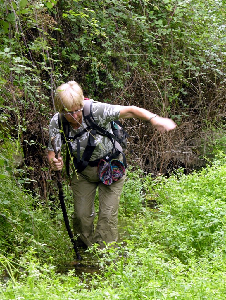
With Simone and Mississippie as excellent companions. After a night baby sitting at Inanda and Arie's home at the Tortelduivenlaan in Brussels we had an early morning start and went by car to Hamme-Mille. From here to the starting point at Jodoigne with TEC line 18.
Plan: GR 579 from here to Bossut.
The starting point is 700m from the village centre on the main road to Wavre. Take the Rue de Chebais in southern direction and follow the well marked path. Many poles used for the well known red-white GR marks were 
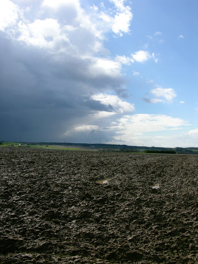
covered by snow from the north west face. Soon we ourselves in hilly countryside. The air temperature was 2- 4 degrees Celsius and soon after we set off the clouds released vast quantities of snow. At regular intervals the sun took a peep to view the magnificent landscape.
The track: 450 m after starting the heighest point was reached at 136 m and at km 16,5 45 m was the lowest. Total climbing was 448 m.
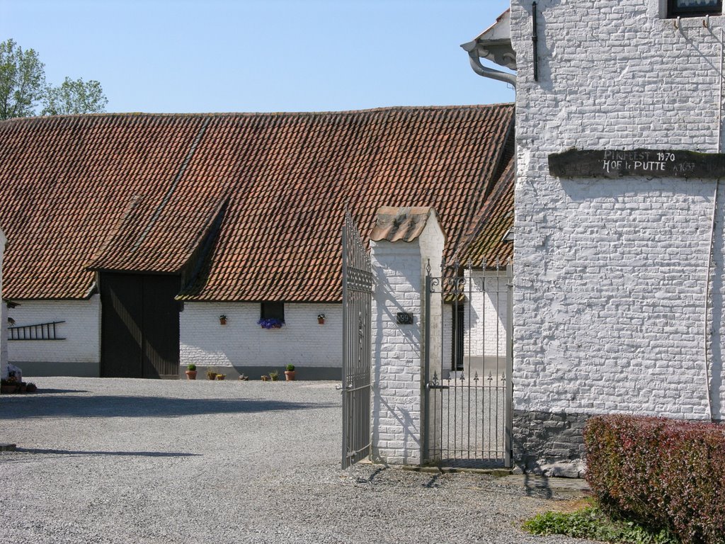
A large part of the track runs though open countryside and we never experienced so many muddy roads in one day. (Rain and snow the previous day were probably the culprits. Only Jodoigne offers some restorative facilities. Hot chocolate would have come as a gift from heaven. Instead we quenched our thirst with icy cold water from our bottles.
Total distance covered: 18 km.
Overall rating: ****

20.11.05


Solo con perro.

Lokeren to Moerbeke. Just into Belgium. A bit sad weather with low clouds and mist. Only 2-5 degrees Celsius. Extremely simple trip: along an old railway track, the remainder follows the Moervaart, a winding canal to drain off the land after man build a big canal: that from Gent to Terneuzen. This canal prevented the natural run off of water.
100% flat. A restaurant/bar at start and finish and one in the middle too in case 14 km can't be done in one go.

Probably also a prerequisite for Belgian hikers.
Rating: ++

14.11.05

Sunday 13th November 2005.

Gr579: from Huldenberg (GR) to Bosut (GR) and on to Hamme Mille.
We left at 8.30 and took 1.30 hrs to get to Hamme Mille where the hourly bus No 344 of the Lijn dropped us 28 minutes later in Huldenberg, the starting point of our hike. Well marked (at times) and bright sunshine, freshly ploughed undulating fields with a hint of mist in the morning brought us 30 km later to our car.
From the most southerly point of this route, near the railway station in Tileul, we left the GR and followed for a short distance the railway, crossed a field and were friendly asked wether we were "perdu" when we walked a very quiet forest lane leading to a castle. We were equally friendly given permission to cross the estate. Past the railway we followed for a short distancethe main road from Waver to Leuven. App. 7 km on a back road we arrived at Hamme Mille. A tarmac road to the east of Bosut carried the well known red-white bars from our lost GR.
At darkness, tired after the 7 hr trip we sank into the seats of our Nissan Prairie.
Summary: Fantastic scenery close to Brussels. Alt.max: 104 m. Alt min: 35 m. Rating:****

2.10.05


1-10-2005
Walking the GR 129 between Landelies and Le Bultia.

Transport: Train Charleroi Sud to Landelies (hourly sevice). Le Bultia: TEC bus No 451 to Charleroi Sud.

Distance: 23 km. Alt.max: 232 m. Uphill: 258 m. Total avg. speed: 3,8 km/hr. Moving: 4.50 hrs. Resting: 1 hr.

18.9.05

Saturday 17 september 2005.
The dog was my companion today. At 9.30 I left by bus (De Lijn No 21) from Sint-Maria Oudenhoven dorp to Ronse railway station. From here on with TEC line 87b to Crimont. At 9.07 northwards on the GR 129 untill the turnoff. East onto GR 122 + GR5a. In Brakelbos the latter turns right and the 122 (direction Zwalm on the sign post) carries on straight up to Sint Goriks Oudenhoven and arrive 6.30 hrs after departure at Grimont. It takes another 30 min. to Sint-Maria Oudenhoven where I parked the car.

Highest point 153 m. Reasonable variation in landscape. Mostly sunny.
Total distance covered: 32 km. Alt.max. 153 m. Quite a few small hills. Total time 8.45 hrs of which 1 hr resting time.
Personal rating: +++

4.9.05

2-9-2005: hiking the GR129 from Lens to Bouvignies: 22 km. Add another 2,5 km to Ath's railway station. The station in Lens is a mere 300 meter from the GR.
Time it took: total 7.00 hrs. of which 1,30 hrs. resting. Total uphill: 180 m. Alt.max. 77 m. Alt.min: 41 m.
Fairly flat with little shade but wide views. Temperature this day 26-29 C. Rating: ++

27.8.05

20-8-2005 Hiking from Ronse to Ath
11.00: train from Ath to Lessine from there on with the bus to Ronse railway station: app. 45 min.
In Ronse take GR5a+GR122 to east and later on the Kanarieberg turn right. For a short distance GR5a, GR122 and GR129 run together. Follow GR129 to Bouvignies and leave GR129 and walk 3 km to Ath railway station.
Plenty of hills (up to 140 m), unpaved roads, kilometers (37+3) and rain (6 out of 7 hrs). Nevertheless beautifull.

31.7.05

30-7-2005: GR 122 Pottes-Obigies: 25,2 km, 5.28 hrs walking; 1.11 hrs resting. Hardly any altitude changes.